Big Easy Trailhead Open!

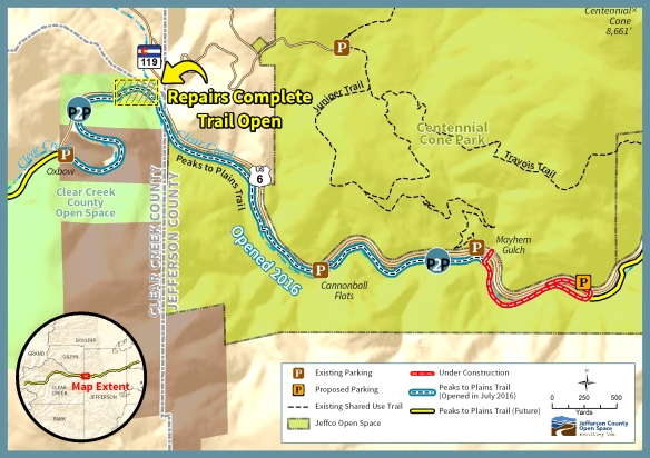
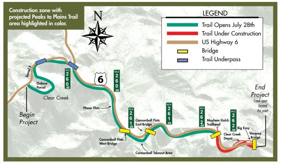
The Big Easy trailhead is officially open! Experience it for yourself at 32088 US Highway 6, Golden. Almost nine miles West of the US6/Hwy 58/Hwy 93 intersection.

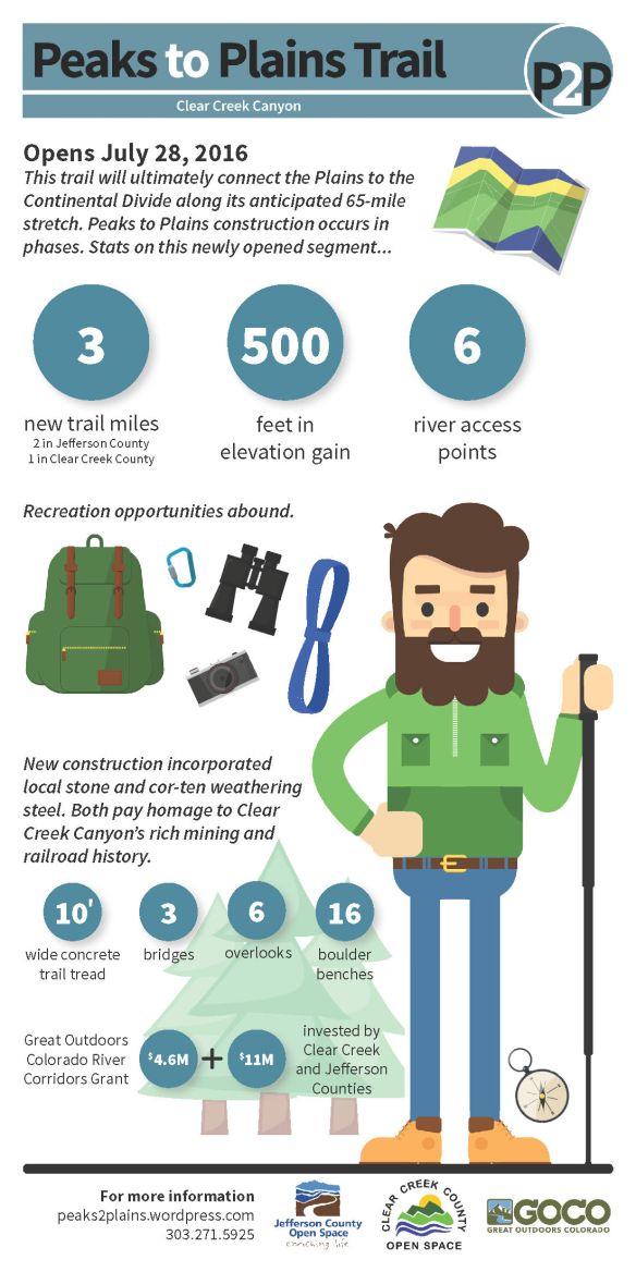
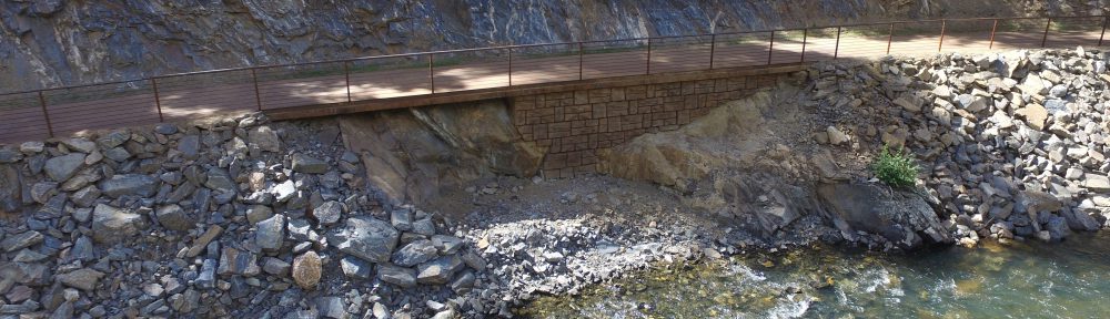
Adding another .75 miles to the Peaks to Plains Trail, The Big Easy trailhead and recreation area has a permanent restroom, 54 parking spaces, fishing platforms over the water, picnic pavilions, a geology garden, and a boardwalk in areas where vegetation needs to be protected. A new bridge also spans the creek, leading onto the Peaks to Plains Trail, which connects to the Mayhem Gulch trailhead westward up the canyon. Opening cable cutting ceremony photos can be viewed here.

Big Easy Trailhead recreation area map

Repairs in Clear Creek County Complete

Image

Repairs to the segment of the Peaks to Plains Trail in Clear Creek County are complete. The entire 3-mile stretch of trail is now open through both Jefferson and Clear Creek Counties!

Clear Creek County section open map

Governor Hickenlooper Visits the Peaks to Plains Trail Project

Video

Governor Hickenlooper, members of his cabinet and both County’s Commissioners toured the 3-mile Clear Creek Canyon segment of the Peaks to Plains Trail project in September, 2016. This trail has been designated as one of the Governor’s 16 Priority Trail Projects in 2016 as part of the Colorado the Beautiful Initiative and we were proud to show it off to such a prestigious group.

Celebrating Opening Day – With Gratitude

Jeffco Open Space, along with Clear Creek County Open Space, opened segments of the Peaks to Plains Trail in Clear Creek Canyon on July 28, 2016. The following video shows the entire process from planning, to construction to completion and highlights the numerous partners who made this possible. Jefferson County Commissioners Donald Rosier and Casey Tighe opened the trail along with Clear Creek County Commissioner Peter Monson. Thank you to everyone involved!

Peaks to Plains Trail Opening Date

On Thursday, July 28, the first phase of the Peaks to Plains trail will be open to the public. Over three miles of paved multi-purpose trail, as well as the three bridges crossing the creek in this joint project of Jefferson and Clear Creek counties, are ready for exploration. Visitors coming from the Clear Creek end will be able to follow the trail around the Oxbow, while visitors from the Jefferson County side will be able to travel west from the Mayhem Gulch trail head to the project beginning. Due to the unusually high water flows in the creek over the past two years, the trail has needed some unanticipated reinforcements and repairs, which has, unfortunately, pushed back the opening date of Phase 1 from July 14, and the grand opening of the trail as a whole until the fall. However, on Thursday, July 28,
Jefferson and Clear Creek counties are proud to open for the public the portion that is completed and safe.

For Your Safety: While some portions of the trail appear to be paved and completed, outdoor enthusiasts are reminded that ALL parts of the area are still construction zones
and that access at these points is still restricted until the trail is opened on July 28, 2016. Please do not enter or utilize the closed sections.

P2P opening map