Notice: Trail Closures 9/18 & 9/19

With the cooperation of fall weather, both Jeffco Open Space and Clear Creek County will be closing sections of the trail on Monday and Tuesday, 9/18 and 9/19 of 2017.

Access to Peaks to Plains Trail from Mayhem Gulch trailhead will be blocked down from the restrooms and through the underpass for staining and maintenance. In addition, Clear Creek County will be closing their section of the trail from the county line to the west side of the box culvert.

Parking is available at Cannonball Flats and the Oxbow lots. However, if parking at the Oxbow, be advised only about ¾ of a mile of trail will be accessible at this time.

Please plan accordingly and thanks for your patience.

Closure Alert: Cannonball Flats Parking Lot Closed April 27-29, 2017

Cannonball Flats parking lot in Clear Creek Canyon Park will be getting a face lift Thursday, 4/27 through Saturday, 4/29. Weather dependent, the entire parking lot will be closed for crews and operations. Please use Mayhem Gulch or Oxbow Parking lots to access Peaks to Plains Trail. Thanks for your patience!

Cannonball Parking Lot Closure April 2017

Bathroom Break

The development of the Big Easy Recreation Area will include a permanent restroom, among other new amenities like picnic areas, and a creek-side boardwalk. A permanent restroom has long been needed here and will be a great amenity when the area opens later this year.

Future location of the new permanent restroom

The new restroom site is starting to take shape. Construction of the new building will start in the coming weeks.

Big Easy BR Inspection

Staff recently took a visit to the fabrication yard to check out progress of the restroom’s foundation.

Big Easy BR Inspection

All the work is inspected and approved before concrete is poured.

Move Over, Highway 6

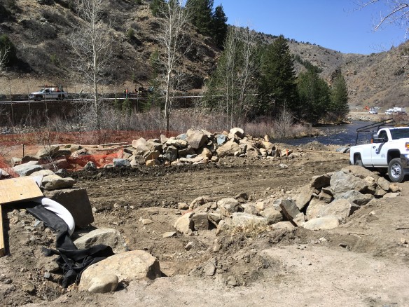
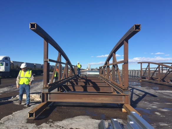
You might have noticed the recent warm weather has brought about a flurry of construction activity along US Hwy 6 in Clear Creek Canyon. This is all part of another 3/4 mile stretch of the Peaks to Plains Trail and the development of the Big Easy Recreation Area which will include parking for over 50 cars, a permanent restroom, multiple river access points, picnic areas and a new bridge across the creek. To accommodate the new parking lot, and allow for safer creek-side access, US Hwy 6 needs to be moved to the north. With a planned opening date of early September, the crews are working diligently to  physically move the highway to the north of its current location near mile marker 262.5.

Please be patient with on-going lane closures and delays as a result of this work (they will continue off an on for the next month or so). Rest assured the new amenities and recreation area will be worth the wait and loved by visitors for years to come.

Rock face being chipped away

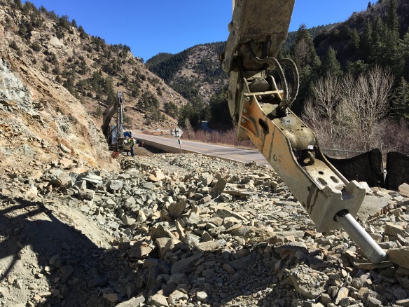
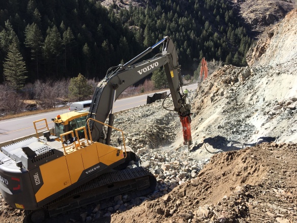
A large rock face needs to be removed to make room for the new highway alignment.

img_1488

The removed rock will be crushed and re-purposed as the road base for new pavement.

Installing nails into bank

The steep slopes above the future highway need to be stabilized using long soil nails, steel mesh, shotcrete, and stone veneer.  Here you can see the drilling equipment installing soil nails.

Stone wall finish

With the wire mesh and shotcrete in place, the future stone veneer allows the wall to blend in with the surrounding area.

new highway

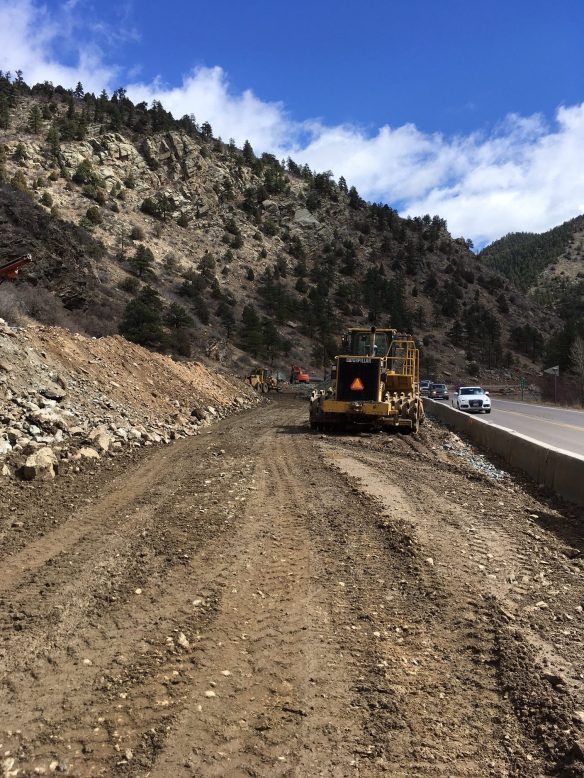
The future highway alignment is beginning to take shape.

Cell tower

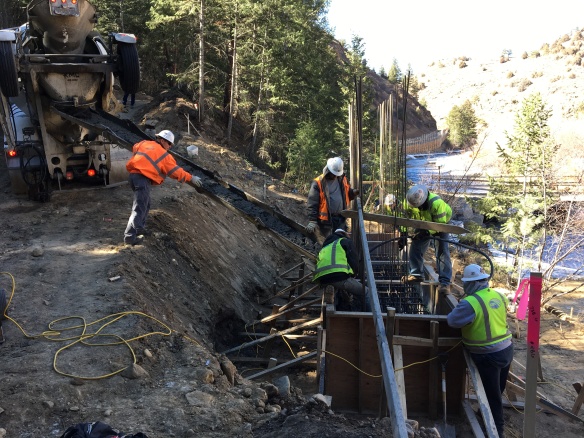
The existing cell tower, fiber optic lines and electrical line all need to be moved as well.

Fiberoptic lines being buried

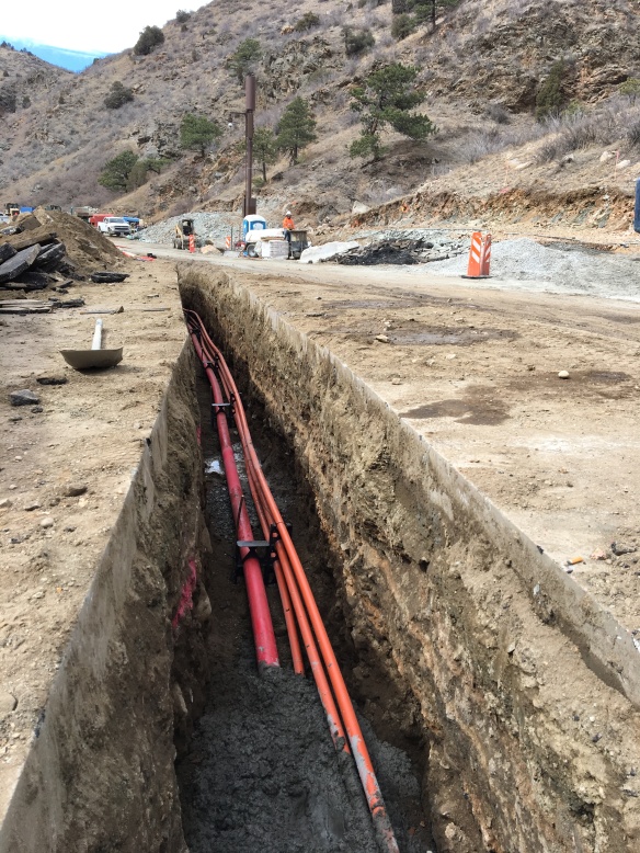
The new lines are encased in concrete for protection.

Buried lines

Before being completely buried, red caution tape is added as a final layer of safety.


Taking Advantage of Warm Weather

Lots of action at the Big Easy helping us meet our goal of opening early fall…

img_1485

Dueling breaker bars slowly cut away bedrock to make room for the new highway alignment

img_1489

Slow going, but you can see the progress

img_1488

The future highway alignment can be seen in the distance

img_1493

Pouring the caisson cap for the new bridge

img_1496

The dry concrete in this photo is the top of the caisson, drilled over 40 feet deep!

CDOT Transportation Alternatives Program Awards Jefferson and Clear Creek County Open Space Funding for Peaks to Plains Trail

Jeffco Open Space (JCOS) is the proud recipient of one of seven Colorado Department of Transportation (CDOT) Region 1 Transportation Alternatives Program (TAP) 2016 grants. JCOS will use the $850,650 to complete approximately 0.5 miles of the Peaks to Plains Trail at the Mouth of Clear Creek Canyon starting at the parking lot just east of Tunnel 1 and heading west around the oxbow. This grant aligns with CDOT TAP priorities in providing safe, alternative transportation for pedestrians and cyclists while increasing motorist safety along US Highway 6.

The project and proposal “had the benefit of being on one of the Governor’s priority trails but the project’s safety improvements, tourism benefit and the amount of financial support and planning that has been done on the corridor helped elevate the project,” stated Region 1 Planning Program Manager, Danny Herrmann. “We’re excited to work with the County on implementing this segment of the trail.”

The Peaks to Plains Trail at the Mouth of Clear Creek Canyon is a 1.75-mile segment of multi-use trail (combining the GOCO Connect grant scope of 1.25-miles and the CDOT TAP grant scope of .5 miles) leading recreationalists away from US Highway 6 and into a scenic area separated from motorists. JCOS estimates completion of this section in 2020.

Jeffco Open Space: Click to enlarge map for scope of projectGOCO TAP Map


In addition, Clear Creek County Open Space was awarded their CDOT TAP application request of $480,000 for the continuation of the Peaks to Plains Trail further westward following the alignment of the abandoned Colorado and Southern narrow gauge railway corridor. The Peaks to Plains Trail: Clear Creek Greenway Canyon Segment, extends from the parking lot just west of Tunnel 5, where the GOCO River Corridor Initiative funded trail project ends, upstream around Tunnel 6 and beyond.

Clear Creek County: Click to enlarge map for scope of projectClear Creek County TAP Grant Proposal

Muller Engineering Company Takes Home Outstanding Engineering Design Award for P2P Trail

Video

Congratulations to Muller Engineering Company for taking home two awards today at the 2017 American Council of Engineering Companies Colorado Engineering Excellence Awards ceremony! Their construction work on the Peaks to Plains Trail in Clear Creek Canyon was awarded the Honor Award for Outstanding Engineering Design and an Outstanding Graphics award. We are honored to have such a fantastic partner for this project.

ACEC Awards

Bridge Fabrication

We recently took a trip to Greeley to check in on the fabrication of the first three of our four bridges, which will be installed mid March. They are made completely out of
Cor-Ten, also called weathering steel, which eliminates the need for painting as the product naturally forms a rust-like appearance when exposed to the elements. Each bridge will have overlooks on both sides to allow visitors to step off the trail and have an unobstructed view of the creek. They are too large to deliver in one piece. Instead they will be sent in four pieces (two bridge segments and two overlooks) connected on site and installed as one piece with the help of a large crane. Enjoy the pictures!


IMG_1001

Welding one of the sides of the westernmost bridge. This is the largest span at just under 136 feet.

IMG_1007

The center connection point. It will be disassembled here for shipping.

IMG_1012

The easternmost bridge. This is the shortest bridge at just under 107 feet. The small holes you see on the vertical members are for the cable safety railing.

IMG_1008

One half of the bridge. Its other half can be seen on the right.

IMG_1013

The middle of the three bridges with a span of just under 122 feet. This had just been sandblasted to remove debris and writing from the fabrication process. By the time this is installed in March it should have a rusty patina again.

IMG_1015

The two pieces of the middle bridge.

IMG_1020

One of the six overlooks. The holes for the cable safety railing can be seen here as well.